MSA SC 5339-16-1
|
|
1976
|
|
|
|
Contact the Department of Special Collections for location.
|
Description
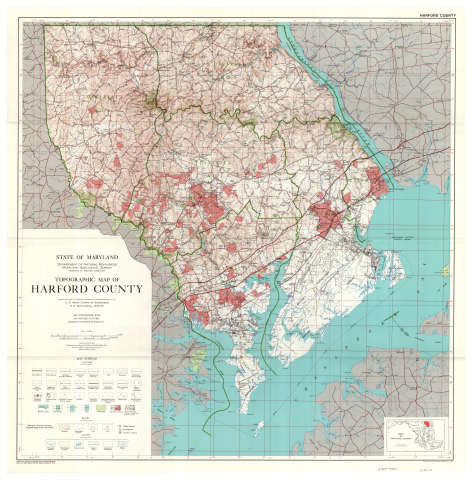
DEPARTMENT OF NATURAL RESOURCES (Library) Topographic Map of Harford County, 1976, MSA SC 1391-9363SL 02-12184, S050001798
|
|
MSA SC 5339-16-2
|
|
1930
|
|
|
|
Contact the Department of Special Collections for location.
|
Description
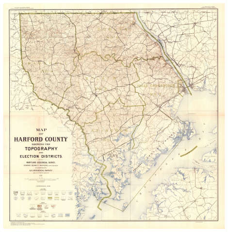
SPECIAL COLLECTIONS (Maryland State Archives Map Collection) Map of Harford County Showing Topography and Election Districts, 1930, MSA SC 1427-956SL 02-12183, S050001796
|
|
MSA SC 5339-16-3
|
|
1906-1912
|
|
|
|
Contact the Department of Special Collections for location.
|
Description
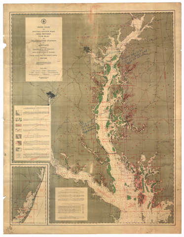
SPECIAL COLLECTIONS (Maryland State Archives Map Collection) Index Chart of Natural Oyster Bars, 1906-1912, MSA SC1427-882SL 02-12182, S050001797
|
|
MSA SC 5339-16-4
|
|
1949
|
|
|
|
Contact the Department of Special Collections for location.
|
Description
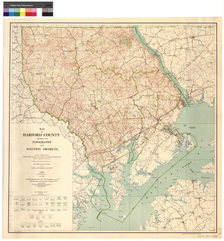
SPECIAL COLLECTIONS (Maryland State Archives Map Collection) Map of Harford County Showing Topography and Election Districts,
1949, MSA SC 1427-1-2396
SL 02-12956, S050001848
|
|
MSA SC 5339-16-5
|
|
1858
|
|
|
|
Contact the Department of Special Collections for location.
|
Description
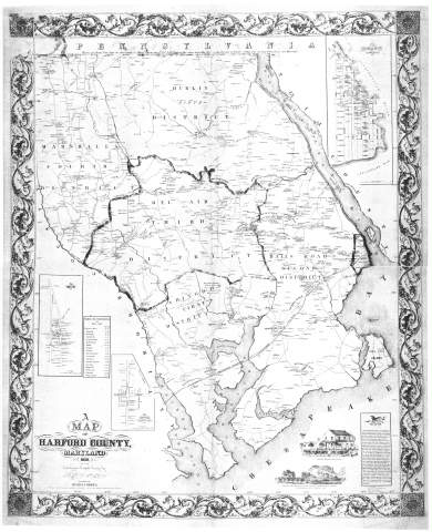
SPECIAL COLLECTIONS (Maryland State Archives Map Collection) A Map of Harford County, Maryland
1858, MSA SC 1427-1-770
SL 02-12187, S050001844
|
|
MSA SC 5339-16-6
|
|
1902
|
|
|
|
Contact the Department of Special Collections for location.
|
Description
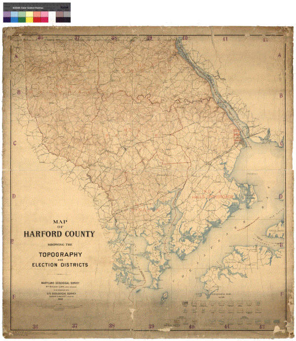
SPECIAL COLLECTIONS (Maryland State Archives Map Collection) Map of Harford County showing the
topography and election districts, 1902, MSA SC 1427-1-418
SL 02-12990, S050001892
|
|
MSA SC 5339-16-7
|
|
1858
|
|
|
|
Contact the Department of Special Collections for location.
|
Description
Jennings and Herrick, Map of Harford County, 1858, Library of Congress. MSA SC
1213-1-. LOC scans on disk S050002109.
Stitch posted 4/23/02
50% jpg and thumb on CD S050002130
Tif and copy of 50% jpg on CD S050002166
|
|
MSA SC 5339-16-8
|
|
1878
|
|
|
|
Contact the Department of Special Collections for location.
|
Description
Simon J. Martenet, Map of Harford County, 1878, Library of Congress.MSA SC 1213-1-466. LOC scans on disk S050002110.
Stitch posted 4/24/02
Tif and 50% jpg on CD S050002167
Thumb on CD S050002151
|
|
