MSA SC 5339-5-1
|
|
1868?
|
|
|
|
Contact the Department of Special Collections for location.
|
Description
Martenet map of Anne Arundel County
|
|
MSA SC 5339-5-2
|
|
1919/10/15
|
|
|
|
Contact the Department of Special Collections for location.
|
Description
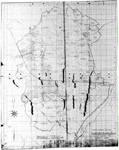
Camp Meade, MD, Property Survey, October 15, 1919, Construction Division, War Dept., Job 6118, Plan No. 632
|
|
MSA SC 5339-5-3
|
|
1846
|
|
|
|
Contact the Department of Special Collections for location.
|
Description
05-067 George M. Bache and F.H. Gerdes. The Harbor of Annapolis.MSA SC 1399-1-618 MSA S 1604-2-17362 Posted 2/25/02
CD S050001975
|
|
MSA SC 5339-5-4
|
|
1858
|
|
|
|
Contact the Department of Special Collections for location.
|
Description
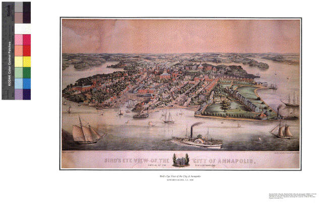
08-112 Edward Sachse. Bird's Eye View of the City of Annapolis.
MSA SC 1213-269 MSA S 1604-2-13555-2 Posted 1/22/02
CD S050001910
|
|
MSA SC 5339-5-5
|
|
1858[?]
|
|
|
|
Contact the Department of Special Collections for location.
|
Description
08-112a Edward Sachse. Bird's-Eye View of...Annapolis. ORIGINAL LITHOGRAPH
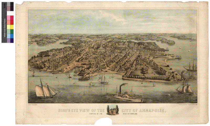
MSA SC 2449-1-1
MSA S 1604-2-17729
CD S050001978
|
|
MSA SC 5339-5-6
|
|
1719 [1784]
|
|
|
|
Contact the Department of Special Collections for location.
|
Description
08-111 James Stoddert. [Plat of Annapolis], 1719 [1784]MSA SC 1427-1-501 Posted 4/2/02
CD S050002096
Thumb on CD S050002130
|
|
MSA SC 5339-5-7
|
|
1885
|
|
|
|
Contact the Department of Special Collections for location.
|
Description
08-116 Sanborn Map Company. Insurance Maps of Annapolis, 1885 [photostat].MSA 1213-1-350 Posted 4/3/02
CD S050002096
Thumb on CD S050002130
|
|
MSA SC 5339-5-8
|
|
1878
|
|
|
|
Contact the Department of Special Collections for location.
|
Description
[08-115] George M. Hopkins, Hopkins Atlas of Anne Arundel County [plate featuring Annapolis], 1878.MSA SC 5439-1-1 Posted 4/2/02
CD S050002095
Thumb on CD S050002130
|
|
MSA SC 5339-5-9
|
|
1908
|
|
|
|
Contact the Department of Special Collections for location.
|
Description
Plate from Sanborn Map Company, Insurance Maps of Annapolis and Eastport, 1908,
Annapolis City Engineer's Office.MSA SC 1213-1-506. Scan from Transparency Posted 4/9/02
Tif on CD S050002072
50% jpg and thumb on CD S050002130
|
|
MSA SC 5339-5-10
|
|
1846
|
|
|
|
Contact the Department of Special Collections for location.
|
Description
George M. Bache and F.H. Gerdes. The Harbor of Annapolis, 1846
[third attempt: 1 photostat, 1 original scanned previously] MSA SC 1213-1-486 Posted 4/16/02
Images 1 & 2 on CD S050002159
Image 3 to be burned
|
|
MSA SC 5339-5-11
|
|
1860
|
|
|
|
Contact the Department of Special Collections for location.
|
Description
Simon J. Martenet. Martenet's Map of Anne Arundel County [detail of Annapolis], 1860MSA SC 1213-1-461 Posted 4/15/02
|
|
MSA SC 5339-5-12
|
|
1860
|
|
|
|
Contact the Department of Special Collections for location.
|
Description
Figure 117. Simon J. Martenet, Map of Anne Arundel County, 1860, Library of Congress, MSA SC 1213-1-117.LOC Images on CD S050002194
Two Images stitched
Posted 5/29/02
CD to be burned; From Richard W. Stephenson, Land Ownership Maps. A Checklist, 1967, no. 281. Lists Geo. W. Beall, Amos R. Harman & Simon J. Martenet as surveyors. 1:63,360, 44 1/2 x 33 inches.
|
|
|
|
MSA SC 5339-5-14
|
|
1649-1665
|
|
|
|
Contact the Department of Special Collections for location.
|
Description
Map of Broadneck Hundred, Anne Arundel County, Maryland, by James Moss, 1949, showing the settlement around the Severn River, entitled: Being ye first Seatinge in this County which was December ye 1-7, anno 1649 and shewing ye Towne of Providence and ye Plantations something as they lay 1663-5.
Original in Special Collections (State House Trust Collection) MSA SC 1096. Color transparency of image exists, but image quality is not ideal for large-scale color reproductions.
Image uploaded to ecpclio created for On Demand Prints reproduction of the map in response to a patron request for a map--repquest came in at last minute. Sasha Lourie and Greg Lepore found the existing transparency to be unsuitable for making a reproduction, and took 4 digital photographs of the map and stitched it together for printing. Digital photography enabled subtle details to be visible. See MSA SC 5458-64-49.
The original map needs to be photographed in pieces and stitched together for creation of a higher resolution image.
|
|
MSA SC 5339-5-15
|
|
1719
|
|
|
|
Contact the Department of Special Collections for location.
|
Description
Stoddert, James
Original plat of Annapolis
Artist/Author: Stoddert, James
A ground plat of the city and port of Annapolis
Accession No.: MSA SC 1427 -1 -6
Location: B5/01/01
300 dpi greyscale tif
|
|
